AUSTRALIA’S FIRST NATIONAL BENCHMARK
OF URBAN CANOPY
Published in 2014, Where Are All The Trees? is Australia’s first ever LGA by LGA study of urban canopy cover. Its 2017 companion guide, Where Should All the Trees Go? updates the figures and shows change over time.
Then in 2017, RMIT and CAUL Hub researchers published a follow-up report called, Where Should All The Trees Go?. This report compared canopy levels overlaid with urban heat and socio-economic (SEIFA) data, to provided an overall vulnerability indicator. These snapshots took those findings and showed how each state rated in either their vulnerability to losing green space, or their success in creating more green space.

WHAT’S IN THE GUIDE?
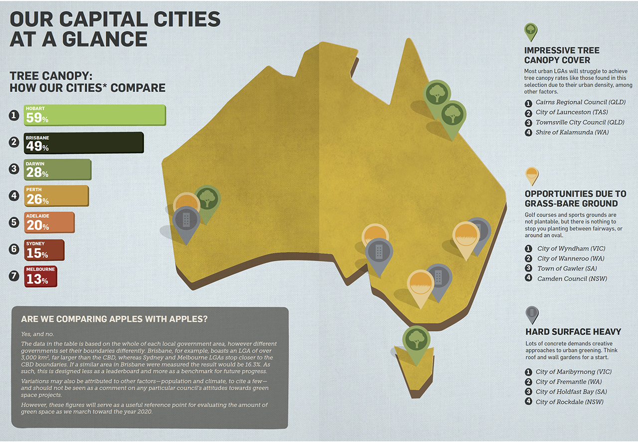
BENCHMARK CANOPY MEASUREMENT FOR EVERY CAPITAL CITY
developed using the open source i-Tree Canopy software

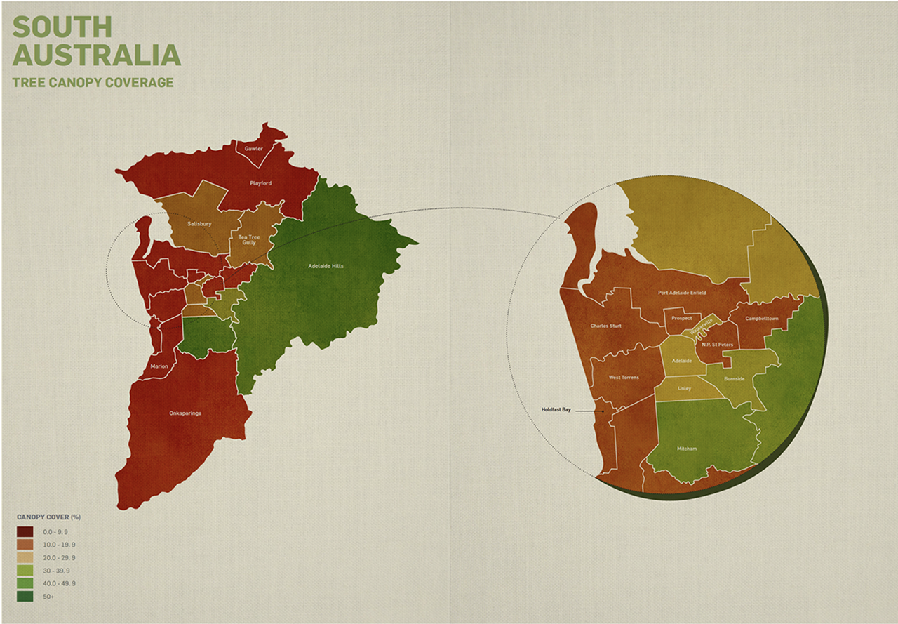
URBAN CANOPY COVERAGE MAPPING
State by state

HIGHLIGHTS FROM OUR CITIES
- 59% Hobart boasts 59% tree canopy cover, making it the #1 capital city in Australia
- 27% By comparison, Adelaide had the lowest proportion of tree canopy among Australia’s capitals at 27%
This report represents Australia’s first comprehensive assessment of urban forest canopy cover. Understanding canopy cover level at a local government scale is critical for effective urban forest management.


